It's April, and the Sierra Nevada is buried under a historic winter. With snowpack exceeding 150% of the recorded average, the mountains will hold their white cover well into late summer. But the days are longer, the snow is stabilizing, and we've made our decision: a spring ascent of Mount Whitney via the Whitney Mountaineers Route.
We picked up our camping permits at the Lone Pine Ranger Station, packed forty-pound bags loaded with crampons and ice axes — essential insurance for the moment evening temperatures drop and the snow turns to glass — and set off.
Conditions couldn't have been better. Our 9 AM start put us on snow that was soft but firm, with no post-holing to speak of. The Whitney Mountaineers Route earns its appeal quickly: it cuts away from the long, endless switchbacks of the main trail and heads straight for the mountain.
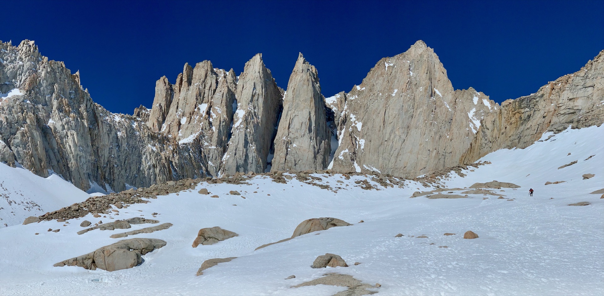
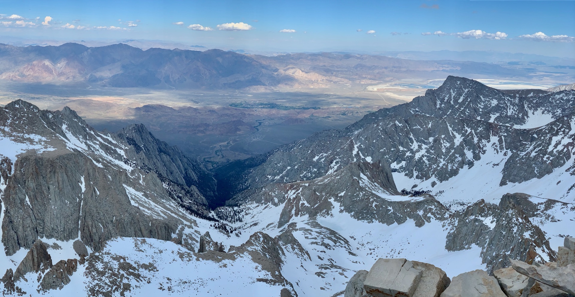
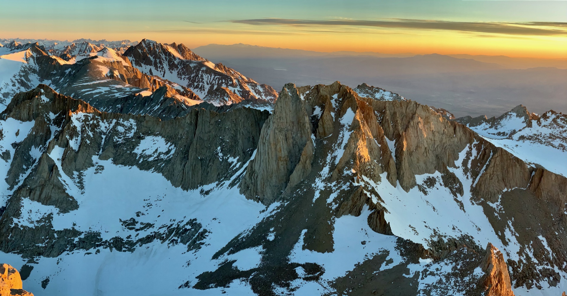
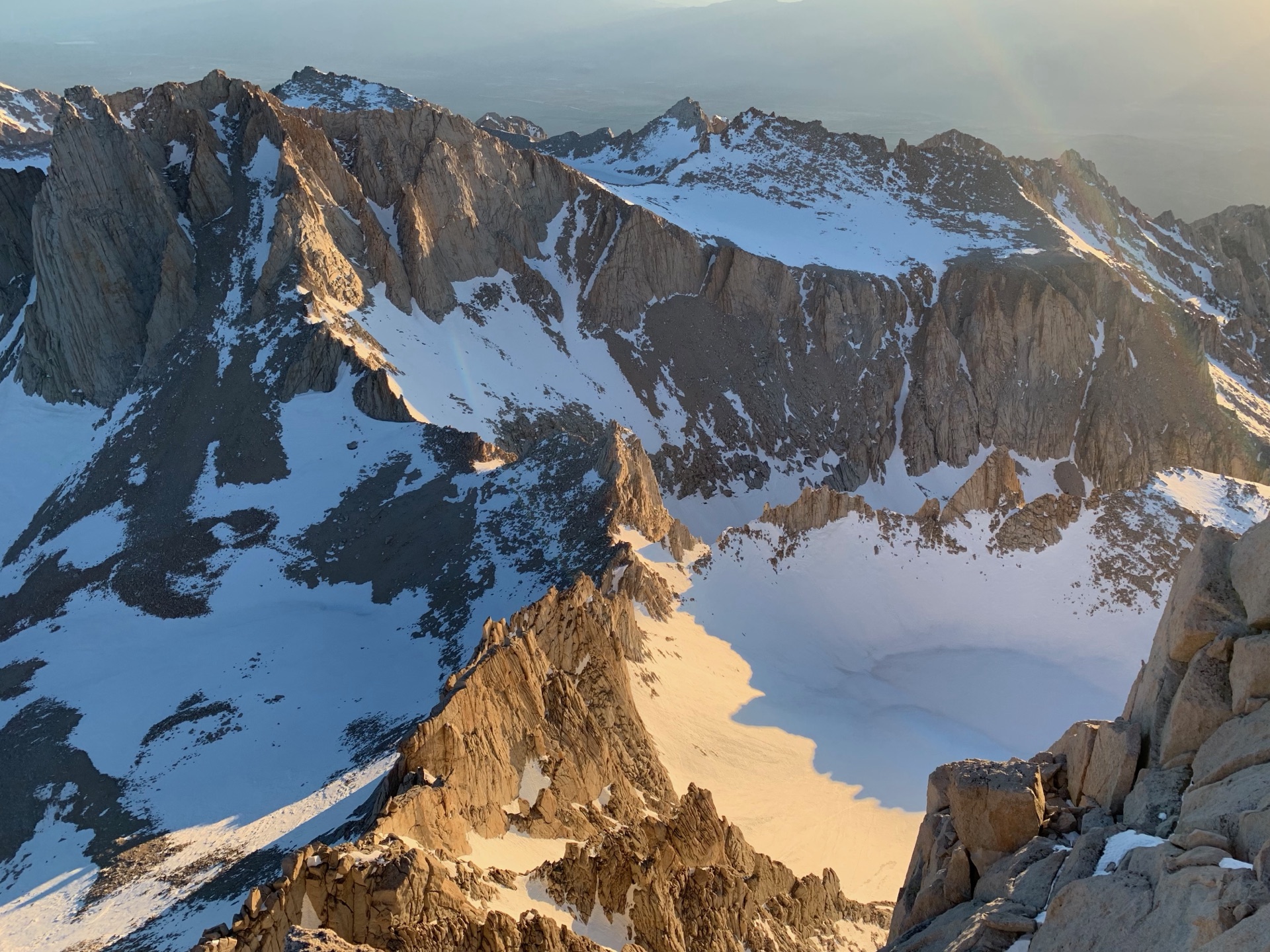
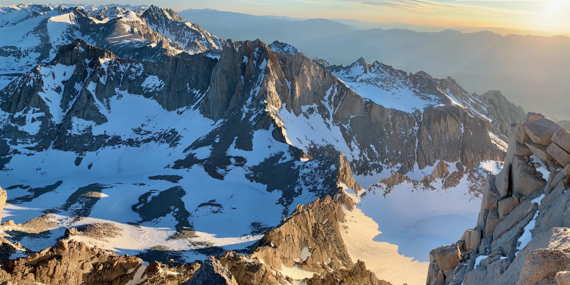
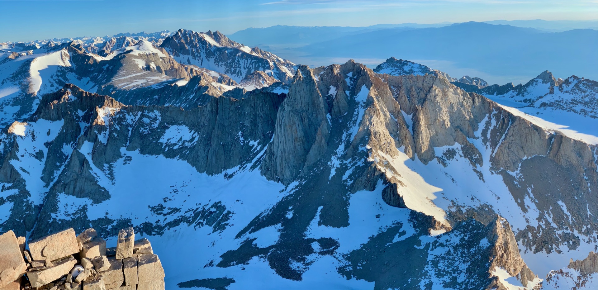
I'd climbed Whitney before, but the views that opened up above Upper Boy Scout Lake still stopped me. The jagged spires known as the Needles rose against a crisp blue sky, revealed in a way the standard route never shows them. A few tents dotted the lakeshore — other climbers on the same route, whom we'd pass on their way down as we pushed up. We moved on to Iceberg Lake, its surface completely frozen and snow-covered, hiding the alpine scenery beneath a seamless white.
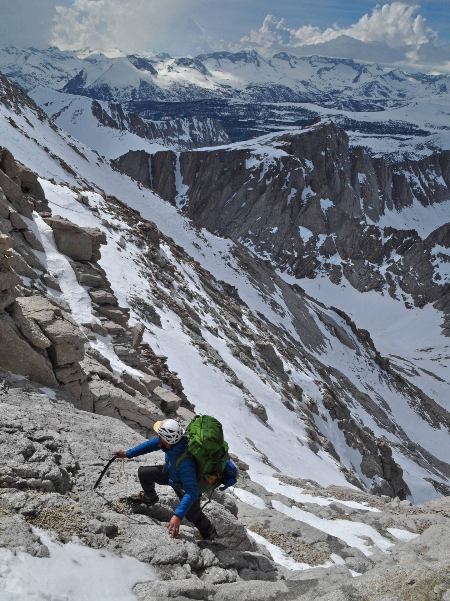
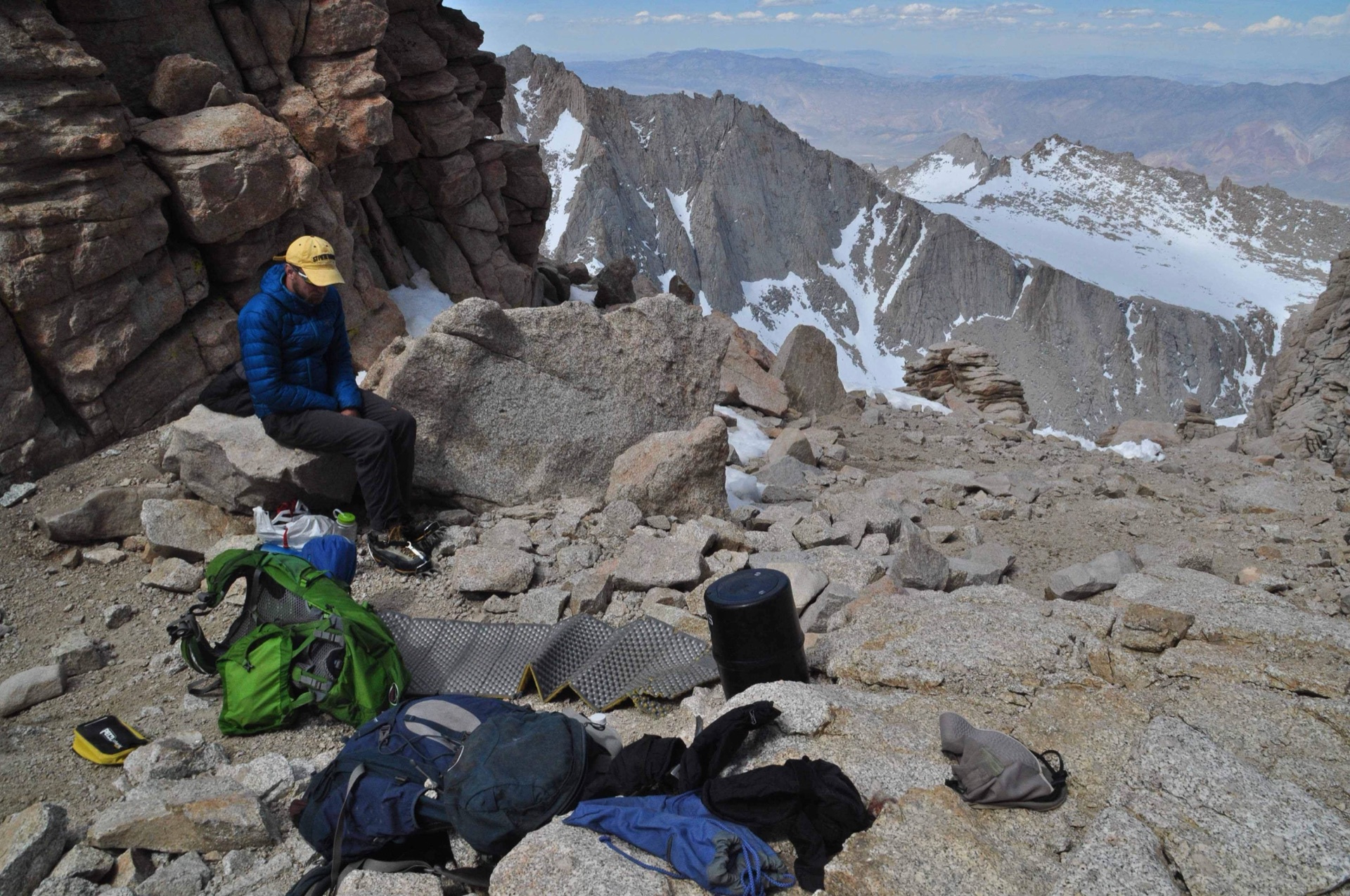
From Iceberg Lake, a steep rocky gully climbs nearly 2,000 vertical feet in half a mile, capped by a short section of third-class rock ledges before the summit plateau. We moved fast — too fast, as it turned out. Somewhere near the Notch, altitude caught up with me: a wave of nausea and a heavy headache. Aerobic fitness, it turns out, is no substitute for acclimatization, and this was the hardest altitude has ever hit me — despite having been to higher elevations before. I lay down, took ibuprofen, ate something sugary, and waited. About an hour later, the mountains gave me back. We continued to the top, arriving in the early afternoon.
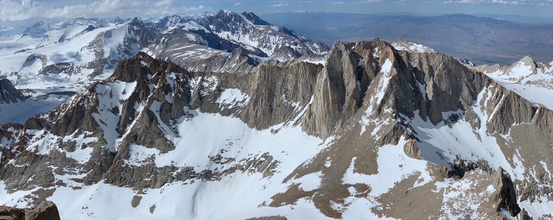
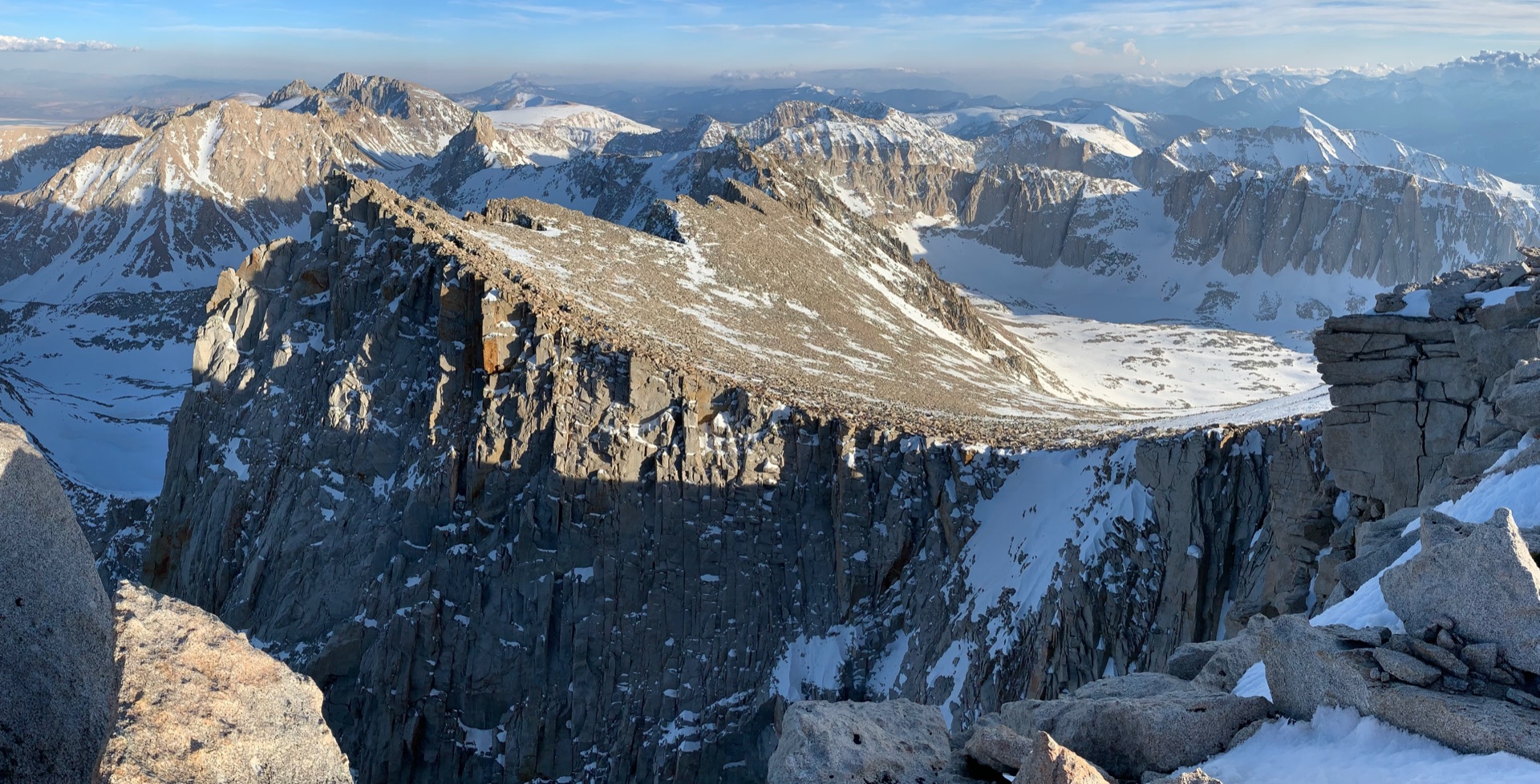
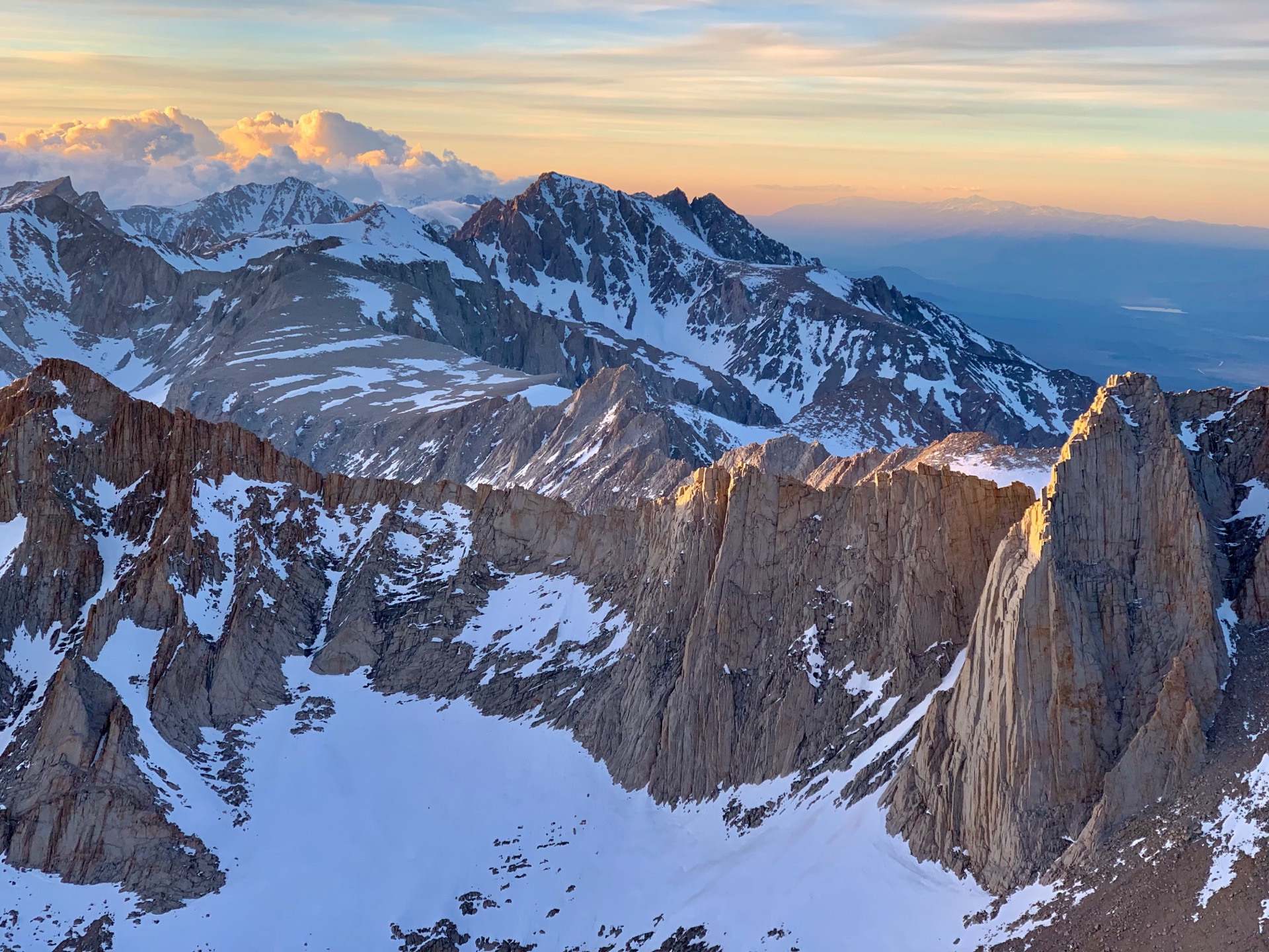
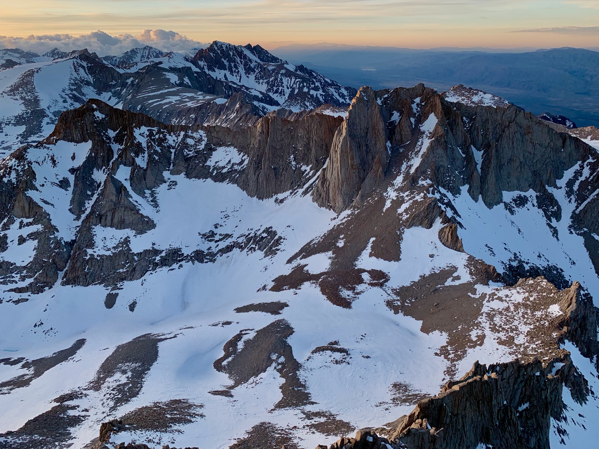
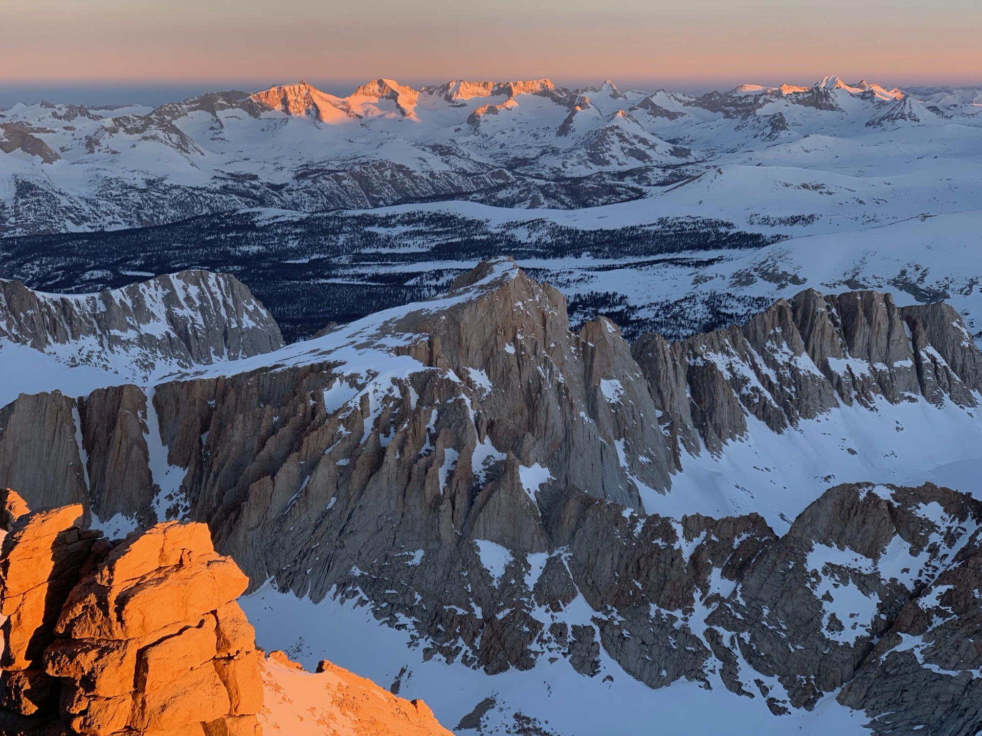
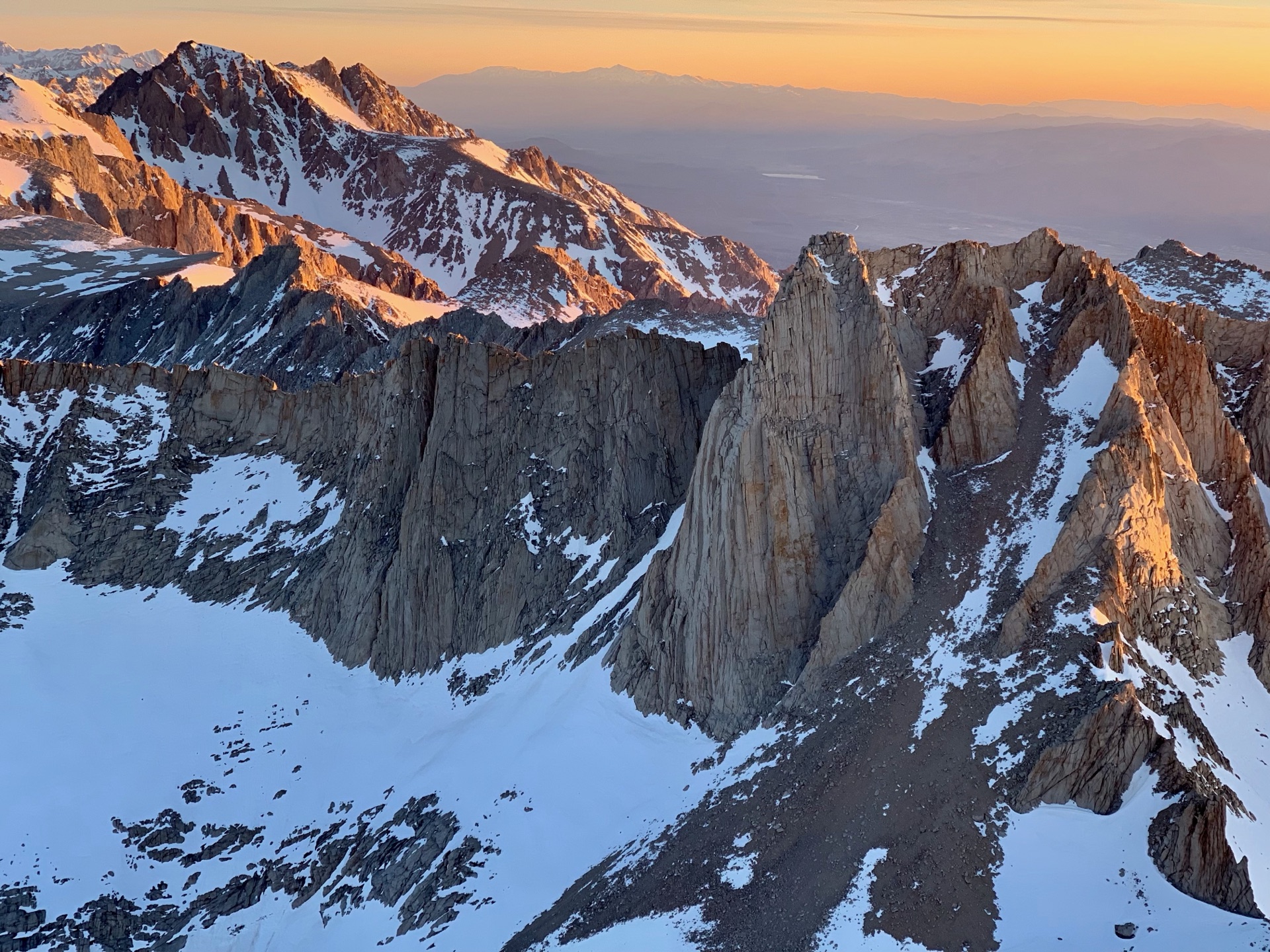
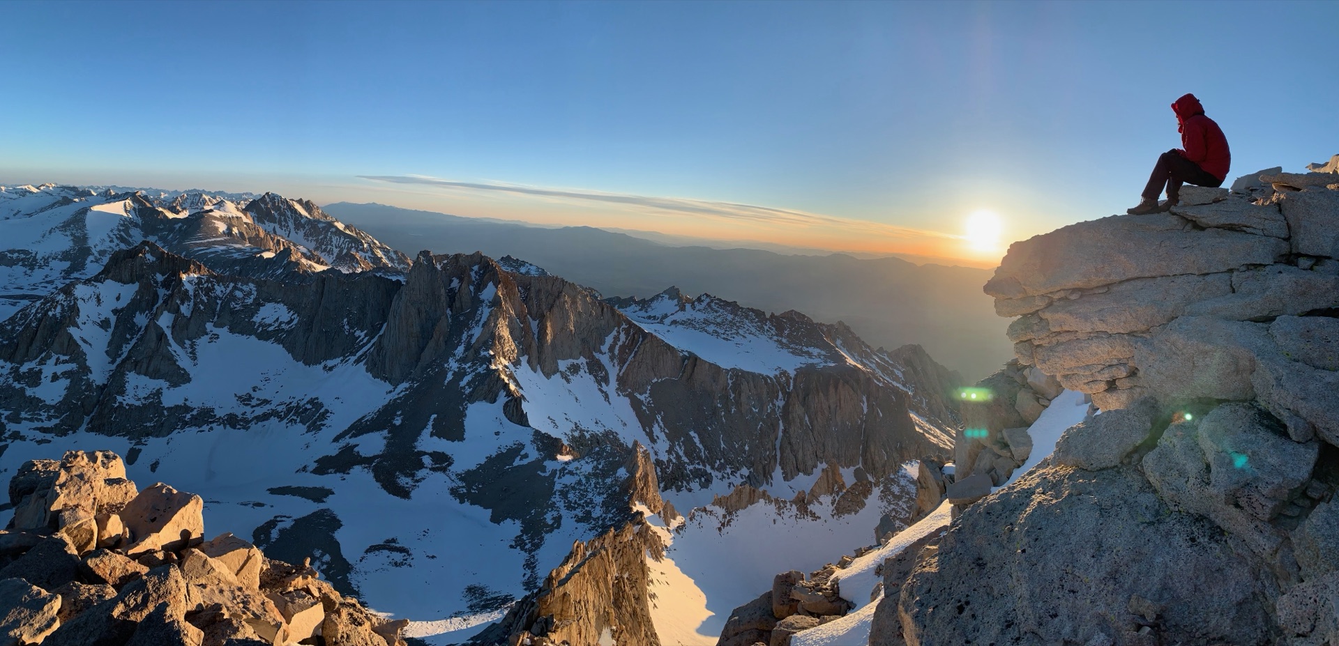
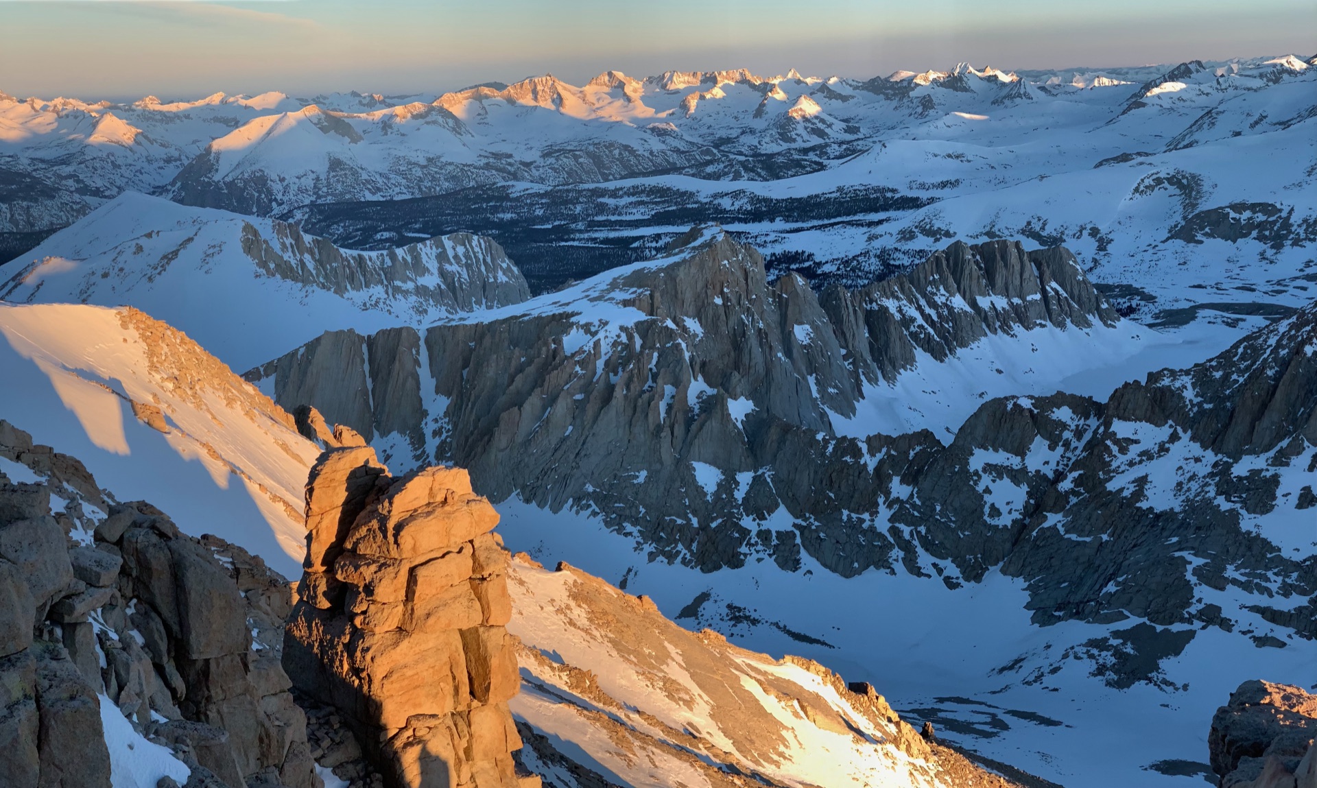
What followed was one of those rare days when the mountains simply give everything. Clouds rolled over distant peaks, sculpting dramatic, shifting vistas. The setting sun turned the granite deep orange, lighting up crack systems and ridge lines I filed away for future climbs.
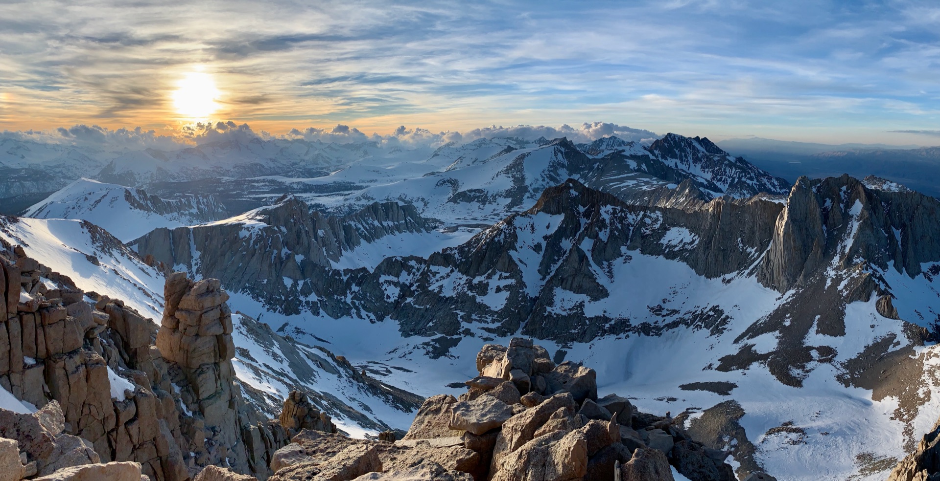
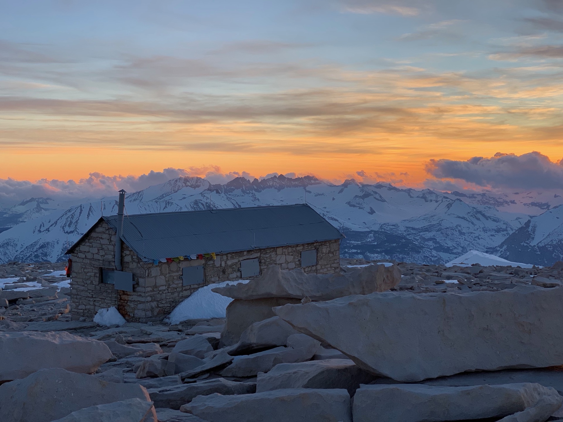
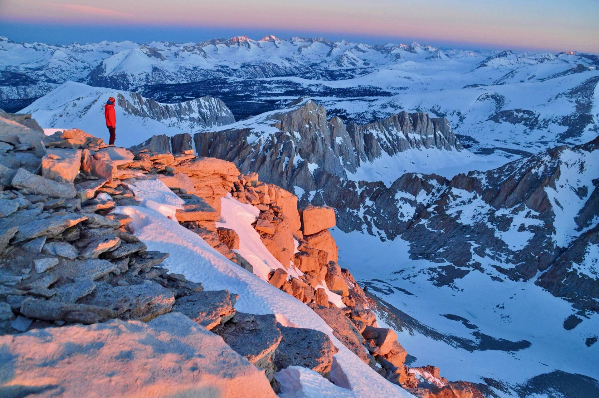
The historic Whitney summit hut stood against a darkening sky. Then sunrise came, and the Sierra peaks glowed in that particular light that earned them their name — The Range of Light. It was a magical stretch of hours, and somewhere in the middle of it I made myself a quiet promise to come back.
For the descent, we dropped onto the main trail and glissaded down the snow-covered switchbacks — the mountain's way of letting you leave quickly and with a grin. Before long we were in Lone Pine, enjoying burgers and talking about future climbs.
What a day. What a night.
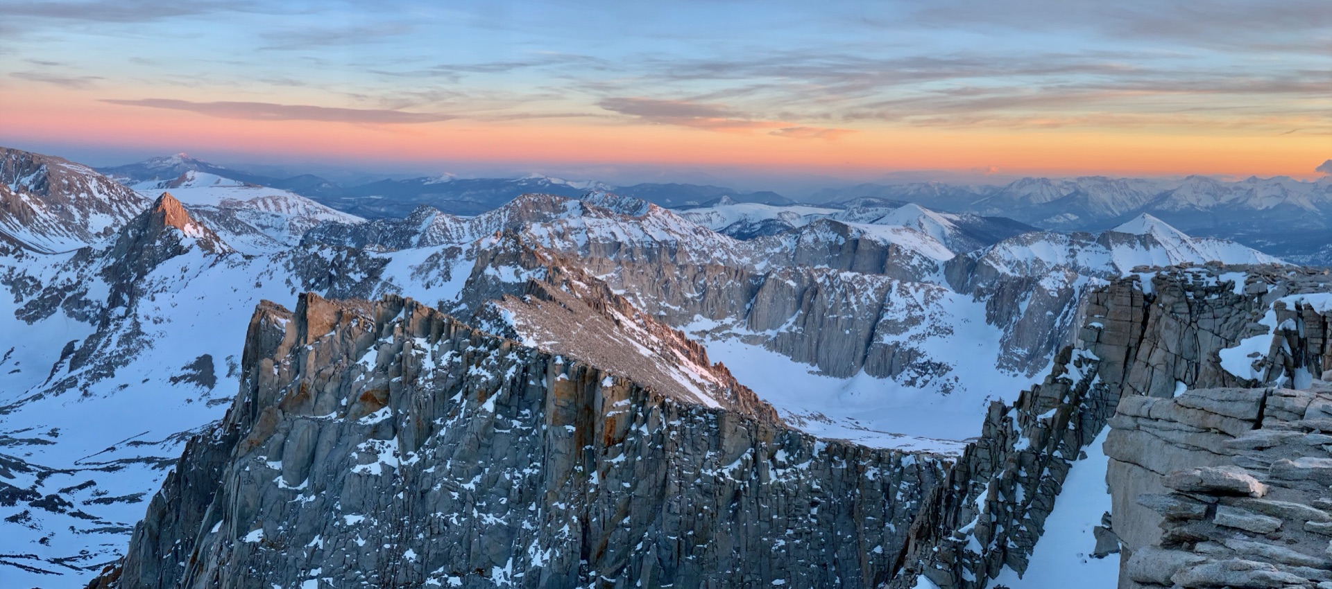
Then sunrise came, and the Sierra peaks glowed in that particular light that earned them their name — The Range of Light. It was a magical stretch of hours, and somewhere in the middle of it I made myself a quiet promise to come back.